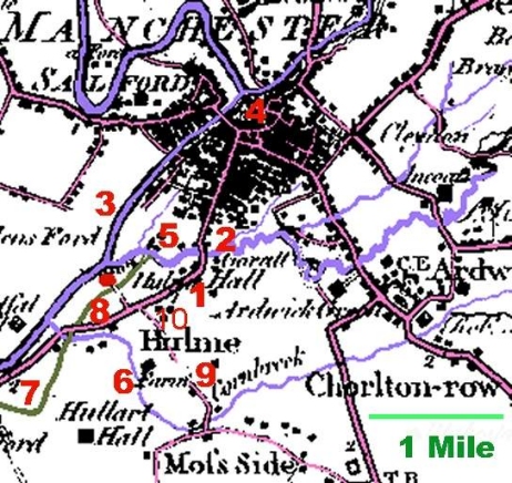
The Yates map is of Lancashire in its entirety, but it has sufficient detail to enable us to see that the hamlet of Hulme (1) was established just south of where the River Medlock (2) joined the River Irwell (3). The township of Manchester at the time had the River Medlock as its southern boundary. The river was about one and a half miles from the centre of Manchester (4). In far-off times, about 70 AD, the Romans had established a fort just north of the River Medlock (and therefore just north of the later settlement that came to be called Hulme) at a site later called Castlefield (5). Hulme Hall, referred to in the previous slide but not numbered here, is seen to be marked by a red dot. Description of this Yates map is continued ...
